The furnace kicked on overnight - it was COLD when I woke up. With a full day of riding in front of me, I thought the thing to do would be to ride the Dragon on the first day of the year - via the Cherohala Skyway, of course. Put a light coat on under my riding jacket and plotted a course to Tellico Plains.
GPS dinked me around a little and eventually dumped me on rt68, which crosses the Hiwassee River and follows it for a few miles. The river was in flood stage.
Rt68 heads twists to Tellico Plains, and early on New Year's Day, I had it all to myself. By the time I got there I was so cold I couldn't feel my hands. I stopped at the Hardee's for breakfast and a hot coffee, and to warm up. I'd lost some time; they were serving lunch already. The cold and my unpreparedness for it had me wondering if I should turn around. After a meal, a coffee, and 1/2 hour of climate control, my confidence returned.
I headed thru "old" Tellico Plains and climbed up the Skyway. Traffic was light, but a few passes put them behind me. It seemed to be warming up, and I was enjoying the fast sweepers, passing into and out of clouds, and capturing it on GoPro. I reached an overlook above the clouds and stopped for the obligatory pics. A retired woman was there with a girl in her early 20's. For reasons unclear, they seem compelled to share a lot of their life story, which was largely punctuated sadness. It wasn't obvious how they were related.
Super T above the clouds.
On the NC side heading towards Robbinsville (now rt 143) a sign at a pull-out seems more "promise" than "warning." I ponder how much elevation change this road has... and how surprisingly warm it was.
Eventually I twist my way past the Thunder Mtn gas station - which seemed to be closed for the holiday - and onto rt 129. The Cheoah Dam reflected the high water seen earlier on the Hiwasee - heavy rains had fallen for several days before my trip. The dam had several gates open and the discharge was impressive - there was whitewater all the way to the 129 bridge, and climbing 129 to the top of the dam covered me in spray. I wish I'd stopped for pics but I was beginning to feel a time crunch. I did NOT want to get stuck in the cold/ dark a long way from camp.
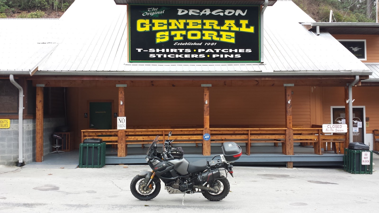
There were a few bikes at the General Store. I pulled in just to re-set the GoPro and headed right up to the TOTD. The cold had started to grip me again and I was riding distracted. At one point I used a pull-out to let what turned out to be a trio of Victories pass me. I was surprised at their speed, but they were crossing the double yellow. My run down was less scary than my first pass on the VStrom had been, but I was going slow and shivering. At the lookout, I pulled off and was having trouble figuring out if/how to deploy my side stand. The cold was starting to affect my judgement, so I stopped to warm up. I warmed my hands on the idling engine and let the radiator fan blow hot air into my gloves. After a few minutes, I turned around and headed back up.
A few bikes passed me coming down, all giving the police "head tap", so I stuck to the speed limit. The speed limit isn't such a bad thing on this road. Near the top the Sheriff passed me coming back down. I pulled into the General Store for a pic and to use the facilities. A Goldwing rider came in after me, took a pic in exactly the same spot, and left as quickly as I had.
It being a fairly long slog home, I battened down and rode straight for camp, with one fuel/coffee/warm up stop in Blairsville. I reached camp at dusk.